This blog post is part of a series jotting through my trip to Israel in June 2019. For contents page for the posts see the Introductory Post. If I've reported something incorrectly, please let me know via post comments (below) or my contact page. All photographs are Copyright © James Oakley, June 2019, unless indicated otherwise.
Day 9, our last full day, we visited areas in the far north of modern-day Israel, considerably north of the lake.
Hazor
We started at Hazor.
Hazor is described in Joshua 10:1 as the largest (head) of all the kindoms in the northern territory Israel was told to capture. When it was excavated, a large area was found to one side of the site of the main tel (mound). Initially, archaeologists concluded this must have been an area for exercising chariorts, because there are no known cities in the ancient world large enough to include that area. (See the mown area to the top of the photo below).
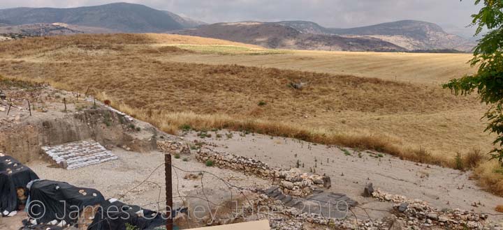
In fact, as they excavated, successively more remains of built-up housing was uncovered, and it became clear that this was part of the ancient city. It was, indeed, the largest of all the cities.
Solomon fortified Hazor (1 Kings 9:15). But there is a marked contrast between Solomon's city and that before the conquest associated with Joshua. Solomon's city was so much smaller. Not only did he not fortify beyond the top of the main mound on which the city was built, but different sets of gates have been discovered.
From the period pre-Joshua, the city had a lower, larger region, with an upper city that was much smaller. The upper city had its own fortifications, so that if the larger full city was attacked the inhabitants could fall-back to defend the highest part separately. The upper city therefore had its own gates, which can be seen today - notice the base of the two basalt jams in the picture below:
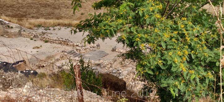
Notice also that, just inside the gateway, there is a rock slab, a high place on which pagan sacrifices would have been offered. A display board at the site notes that "similar cultic installations located at city gates were demolished during Josiah's religious reforms (2 Kings 23:8)."
By contrast Solomon's gate only controls access to the hilltop that he secured.
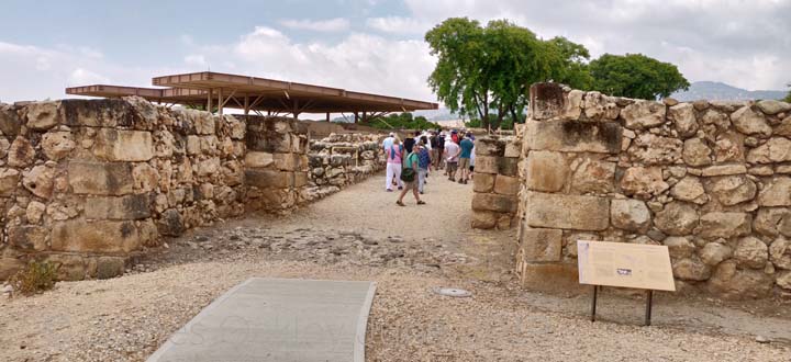
As you can see, the Solomonic gate is very well preserved. (Part of the joy of a visit to Israel is that these ancient rocks are not fenced off - you can walk freely amongst them.)
This shows how much smaller the power-base was in the time of Joshua and of Solomon compared to the Canaanites that occupied these cities before the occupation. Only God's power explains how a far smaller nation, without military technology such as chariots, could capture such a mighty and militarily superior people.
The main palace in Hazor has been found too. It is thought this dates to the period shortly before Joshua. Indeed, there is clear evidene of fire-damage throughout, suggesting that this is how the palace was finally destroyed.
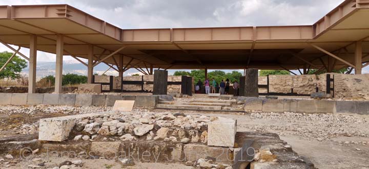
(This was the palace of Jabin, as per Joshua 11:1. For a while, historians wondered how Jabin was still around in Judges 4:17. Later discoveries showed that "Jabin" was in fact the title of the king for the time being of Hazor, rather than his proper name, much as "king" or "Pharaoh" might serve in other contexts).
Hazor is visibly on a prominent hilltop, with a commanding view in all directions. You can see why Solomon (and many before him) fortified and garrisoned Hazor. Of course, a hilltop fort needs access to the water beneath. Who can resist the chance to descend another cistern.
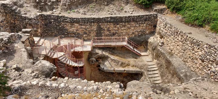
You can see the original steps on the right, built in the time of King Ahab. The modern steps have been supplied to protect the ancient stairway from wear. This one suffers from dust and rubble falling in, so that keeping the cistern and its paths clear is like painting the Forth Bridge. They asked the help of those who visit, if they're so inclined, to carry some of the rubble back to the surface after their trip down the cistern. I was more than happy to do my share to keep this wonderful site in good order.
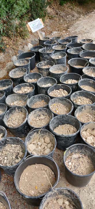
(Before you get the wrong idea - only one of those buckets was mine!)
Dan and Laish
Second port of call was further up country, at the Tel Dan Nature Reserve. There are two sources for the River Jordan, and this was one of them - a lush, green, cool, fertile area with much wildlife, and a noisy rushing river formed from the springs here.
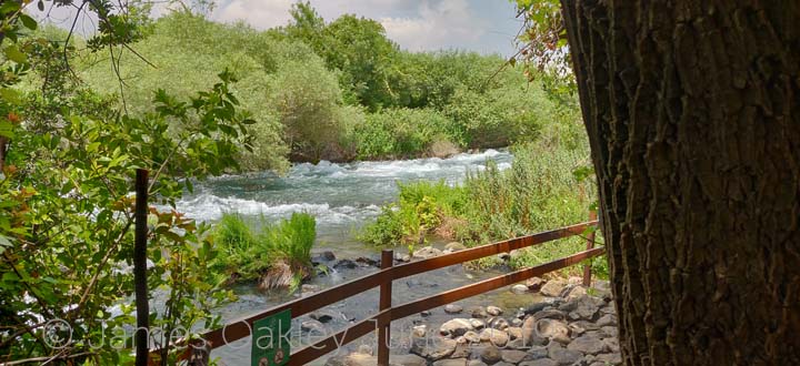
This is a significant place in Israel's history. The tribe of Dan was originally given an area of land on the coastal plain, roughly where modern Tel Aviv is. They were unable to conquer their land, so lived amongst the other tribes until the end of the book of Judges. Then, we read in Judges 18 how some Danites travelled and came to the ancient city of Laish. They saw that its land "lacked nothing" so the people were prosperous. They also had no nearby allies, so were defenseless. They captured their city, even though it was outside the borders of the land God had given to Israel. The way the account is told in the book of Judges, it's clear God was not pleased.
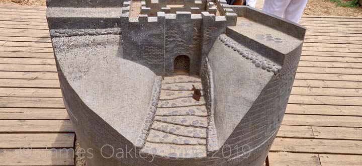
Actually, Laish may not have had allies nearby, but it was far from defenseless. Their city gate, some 3,700 years old, has survived.
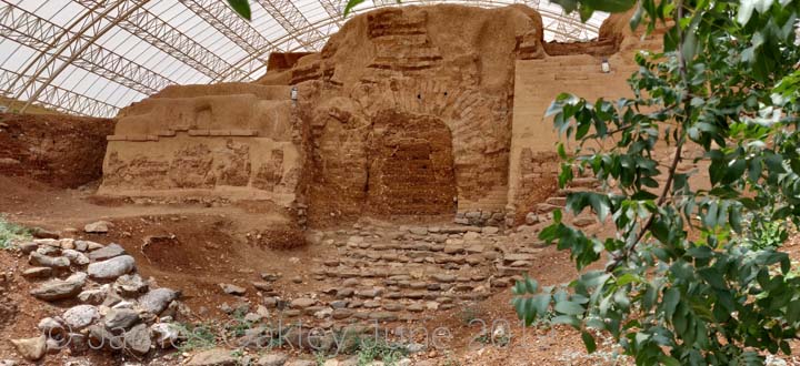
Note the arched structure. The Canaanites were building with arches long before the Greeks or Romans. Here's a model of how this gateway would have looked when the city was inhabited and the gate in use.
The Danites renamed the city Dan after their tribal ancestor, and rebuilt it.
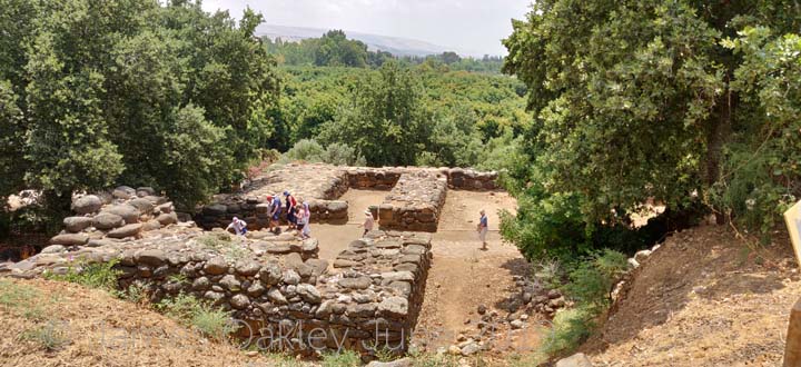
The relatively more recent city of Dan has also survived well. Here is yet another ancient city gate:
The city of Dan became infamous later on. After Jeroboam split the northern 10 tribes away from Rehoboam the son of Solomon, he did not want the people returning to Jerusalem to worship. So he built altars at Dan and Beersheba, with golden calves as focii for the people's worship.
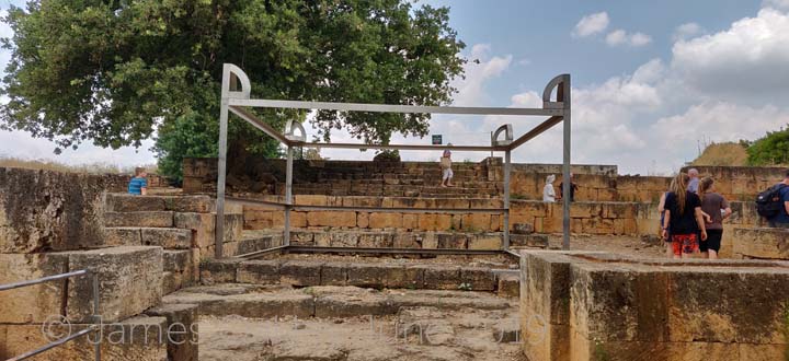
The altars and the calves have not survived, but the faux temple he built has. The archaeologists have put a metal structure where the altar would have been, to give a sense of its immense size. Although huge, the altar at the Jerusalem would have been far larger, but this was imposing enough to give the people the feeling it was a good substitute.
Caesarea Philippi and Banyas
Last port of call was the other source of the Jordan, the Hermon springs. These are where the waters flowing off Mount Hermon in southern Lebanon come out at ground level, and form the Hermon River. This joins the Dan River downstream to form the Jordan.
This was another walk through a nature reserve, starting by the ancient caves at Banyas, where many gods have been worshipped by many different peoples. The name Baynas is a distortion of Panyas, after the god Pan who had a shrine here.

In the time of Jesus, the town here was Caesarea Philippi, renamed after the Roman emperors by Philip the Tetrarch, and so called "Philip's Caesarea" to distinguish it from the other Caesarea on the Mediterranean coast.
It was here that Jesus asked his disciples who people say he is, prompting Peter to pronounce that Jesus is the Christ or Messiah.
Another pleasant walk from the caves takes you past a bridge from the Roman era,
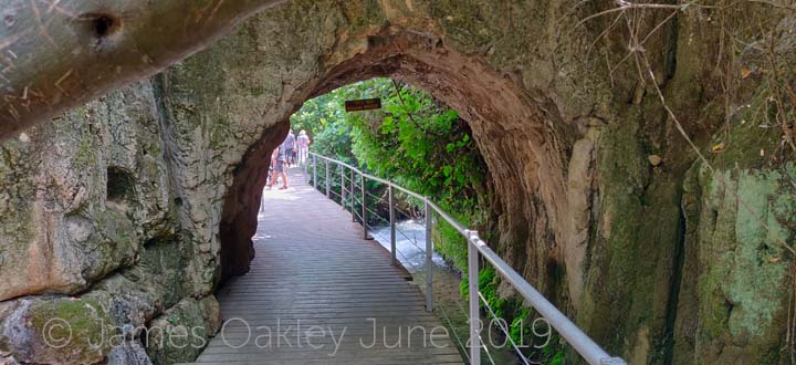
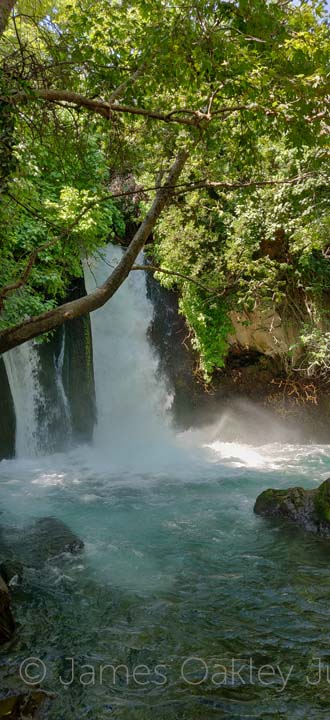
to reach the Banyas Falls, majestic waterfalls where water literally thunders into the river below. It's one of those waterfalls that's hard to describe the noise, the power and the wet spray.
Syrian Border
At the Banyas falls, we were only about 3 miles south of the Lebanese border. We'd travelled all the way to the northern borders of Israel. On our way back, we drove through the length of the Golan Heights. The UK Foreign Office does not advise anyone to go east of the main road south, but our route just took us along the main road. At one point, the road passes very close to the Syrian border, so we stopped to look over the border.
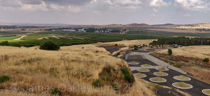
It's hard to see the border in the photo. The grassy mounds in the foreground are part of a new tourist attraction being built (the Golan Volcanic Park). Behind that can be seen a United Nations compound. Behind roughly the middle of that, breaking through the yellow hills on the horizen, there is a 3 metre high wall that gentle curves left to disappear out of the photo to the left. Behind that is Lake Quneitra, definitely on the Syrian side.
That is the nearest there is to a border. Our road formed the western boundary of a demilitarised zone between Israel and Syria. The UN are there to ensure this is observed. The wall is the middle of the demilitarised zone, and there is a similar sized strip of demilitarised land the Syrian side. Israel and Syria may not be fighting, but they have never formalised a peace deal either. On the hill behind our layby was a large amount of Israeli military equipment, camps and listening posts.
Recent comments